








WASHINGTON: The El Nino weather pattern picked up strength over the past month and is highly likely to “rank among the largest” ever recorded when it peaks between October and December, US forecasters said Thursday.
El Nino warms surface temperatures in the central and eastern equatorial Pacific Ocean, triggering worldwide changes in winds, pressure and rainfall patterns.
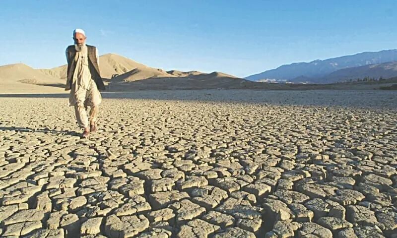
It typically takes place every two to seven years and lasts around nine to 12 months, and it can lead to droughts in some parts of the world and flooding in others.
In its latest update, the US Climate Prediction Center (CPC) said there is an 81 percent chance of a “very strong” El Nino between October-December that would rank among the largest such events in the historic record going back to 1950.
“Very strong” is defined as being 2.0 degrees Celsius (3.6 degrees Fahrenheit) or more above an index value. The CPC also put the odds at 97 percent that the event will persist through early spring 2027.
El Niño continues and will strengthen through the end of the year, with a 97% chance it will persist through early spring 2027. An #ElNino Advisory remains in effect. #ENSO https://t.co/5zlzaZ1aZx pic.twitter.com/ASC46wKOn4
— NWS Climate Prediction Center (@NWSCPC) July 9, 2026
El Ninos typically have knock-on effects globally, including drier conditions and drought in Australia, wetter winters in East Africa and the southern United States, and warmer overall global temperatures.
“Even the strongest El Nino events do not lead to the typical impact everywhere, but stronger events can more significantly tilt the odds in favour of expected outcomes,” the CPC said.
Sea surface temperatures are now 1.2C (2.2F) above average in a defined stretch of the equatorial Pacific known as the Nino 3.4 region, the CPC said.
Combined with warming waters below the surface and shifting wind and pressure patterns, the “ocean-atmosphere system reflected a strengthening El Nino.”
While El Nino usually peaks between November and February, the resulting spike in temperatures typically comes later.
Compounded with human-induced climate change, the last El Nino contributed to making 2023 the second-hottest year on record and 2024 the all-time high.
Record-breaker El Nino
On Tuesday, a top expert said the current El Nino weather phenomenon is expected to break records for its overall strength.
This year’s El Nino is unlike anything seen in more than three decades of tracking the phenomenon, with forecast models pointing to an “extreme” event, said Tim Stockdale, an El Nino expert at the European Centre for Medium-Range Weather Forecasts (ECMWF), an intergovernmental organisation.
“I think it’s absolutely true to say we’ve never had a forecast of an El Nino that was so strong and so consistent across (forecast) models,” he said in a media briefing.
Stockdale said it would be “a very, very big surprise” if the event failed to be a record-breaker.
“I would expect it to break records,” he said, while cautioning: “but no guarantees.”
While El Nino usually peaks between November and February, the resulting spike in temperatures typically comes later.
Combined with human-induced climate change, the last El Nino contributed to making 2023 the second-hottest year on record and 2024 the all-time high.
Floods, droughts, wildfires
The US weather agency declared last month that El Nino had developed and would intensify into potentially historic strength.
Last week, the World Meteorological Organisation said El Nino would quickly develop into a strong event between July and September.
UN food aid agencies appealed last month for funds to enact prevention measures over El Nino.
Many parts of Asia experience drier-than-average conditions and drought during El Nino years.
El Nino can suppress the monsoon over South Asia, depriving India and other parts of the subcontinent of vital rain that supports hundreds of millions of people.
El Nino also raises the likelihood of drought, heatwaves and wildfires in Australia as warmer-than-average conditions grip the continent.
It is often associated with increased rainfall in parts of the Horn of Africa.
But swathes of southern, west, central and eastern Africa usually see drier-than-normal conditions.
Parts of western South America, including coastal Peru and Ecuador, often see above-average rainfall during strong events, raising the risk of flooding and landslides.
In contrast, the weather pattern is tied to drier-than-average conditions in northern Brazil, increasing the risk of wildfires in the Amazon.