








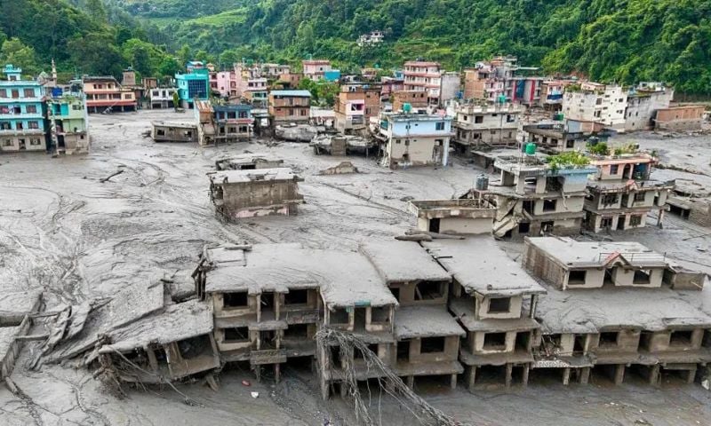
NEW DELHI: The devastating floods that have swept across Nepal and left more than 1,000 people dead have highlighted a growing cross-border threat for India, where several major rivers originating in the Himalayas flow into the densely populated northern plains.
The disaster has renewed attention on the complex relationship between flooding in Nepal and the risks faced by neighbouring India.
Experts say it would be misleading to assume that severe flooding in Nepal automatically translates into an equally devastating flood downstream.
Hey Bhagwan I’m speechless. 💔
I can’t imagine the pain of watching your entire world being swept away like this. 😢 Praying for everyone affected. May everyone stay safe and find strength through this tragedy. 🙏🇳🇵#Nepal #Flood #PrayForNepal #StaySafe pic.twitter.com/DiIMGVAKQr— 𝗕𝗮𝗺𝗱𝗲𝘃R (@Bamdevrijal) August 29, 2026
Instead, the scale of a disaster in India depends on a combination of factors, including rainfall in Nepal and India, river levels, sediment loads, embankments, barrages, drainage systems and development along floodplains.
The latest events have nevertheless served as a warning that the two countries share a highly interconnected and increasingly volatile Himalayan river system.
Rivers linking Nepal and India
Nepal has more than 6,000 rivers and streams, most of which drain southwards towards India and eventually into the Ganges basin. Among the most important transboundary river systems are the Kosi in the east, the Gandaki in central Nepal and the Karnali in the west.
The Mahakali, known as the Sharda in India, also forms part of the western border between the two countries.
Several smaller rivers originating in the Siwalik, Chure and Terai regions – including the Bagmati, Kamala, Rapti and Babai – can also cause serious flooding.
Nepal faces another devastating flood as raging waters sweep through communities leaving destruction behind pic.twitter.com/4Rrt83oIpR
— Sonu (@sonucnc) September 3, 2026
Hydrologists say these smaller rivers can be particularly unpredictable because their catchments are relatively small and steep, allowing intense rainfall to produce rapid rises in water levels.
According to the BBC, Manish Shrestha, a hydrologist at the International Centre for Integrated Mountain Development (ICIMOD), said seven to nine major rivers flowing from Nepal into the Indian plains were significant contributors to flooding in India.
India’s Central Water Commission identifies the Kosi, Gandak, Bagmati and Ghaghara among the principal transboundary rivers.
Bihar faces the greatest exposure
Among Indian states, Bihar is by far the most vulnerable to flooding from rivers originating in Nepal. Around three-quarters of north Bihar is officially classified as flood-prone, while many of the rivers responsible for recurring floods in the region originate across the border.
The Kosi, often referred to as the “sorrow of Bihar”, is the most notorious, while the Gandak, Bagmati and Kamala also pose major risks. The threat, however, is not confined to Bihar.
No dramatic edits. No exaggeration. Just the raw reality of the Nepal floods. 🌊💔
Watch until the end… this is terrifying. pic.twitter.com/EmeCzpTkZK
— American Girl (@American62356) September 3, 2026
Parts of eastern Uttar Pradesh are exposed to flooding from the Ghaghara, Rapti and Gandak rivers. Districts including Gorakhpur, Bahraich, Lakhimpur Kheri and Shravasti have repeatedly experienced flooding. Uttarakhand is linked to the Mahakali-Sharda river system, while parts of north Bengal are vulnerable to rivers such as the Mechi and Mahananda.
Pradeep Man Dangol, a hydrologist at ICIMOD, said Bihar remained the largest area of concern, but Uttar Pradesh represented a significant and comparatively under-reported part of the risk.
Rainfall is only part of the equation
Experts say the impact of flooding in India can broadly be understood through three interconnected stages: rainfall, river behaviour and conditions downstream.
The amount and location of rainfall are crucial. Flood peaks reaching India are not necessarily generated in the high Himalayas.
Intense monsoon rainfall in the lower Himalayan foothills, including the Siwalik, Chure and Terai areas, can produce particularly rapid flows because of steep terrain and small catchments.
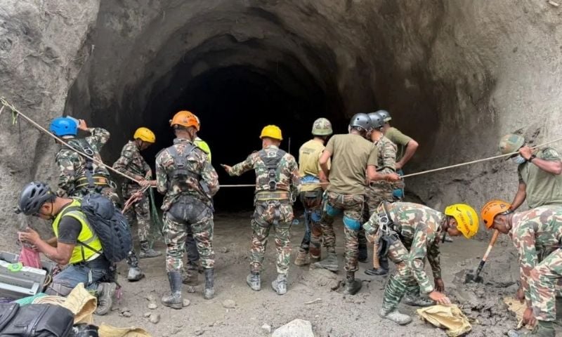
As rivers descend from the mountains, they encounter a dramatic change in gradient. Large quantities of sediment can be deposited, causing channels to shift and water to spread across the plains. Once the floodwater enters India, the severity of the resulting disaster depends on local conditions.
These include rainfall within India, existing river levels, the condition of embankments, the operation of barrages and the ability of drainage systems to cope with the incoming water.
Saswata Sanyal, ICIMOD’s intervention manager for disaster risk reduction, said rainfall in Nepal largely determined the peak flow reaching the border, while the eventual severity of flooding depended at least as much on conditions in India.
The Kosi disaster offers a crucial lesson
The catastrophic 2008 Kosi flood demonstrates why a major disaster cannot always be explained simply by exceptionally high river flows. Nearly 400 people died in Bihar after the Kosi breached an embankment in Nepal.
However, according to Rajiv Sinha, a professor of earth sciences at the Indian Institute of Technology (IIT), Kanpur, the river’s flow at the time was only around a tenth of its carrying capacity.
The disaster was instead linked to the failure of an embankment constructed decades earlier and inadequately maintained.
Sinha said embankments built during the 1950s and 1960s had deteriorated and developed vulnerable points, eventually allowing the river to break through and flood areas that had not experienced such flooding for decades.
Sanyal described the failure as essentially “structural, not hydrological”. The episode underlines the importance of infrastructure maintenance and floodplain management alongside monitoring rainfall and river levels.
How much warning can India receive?
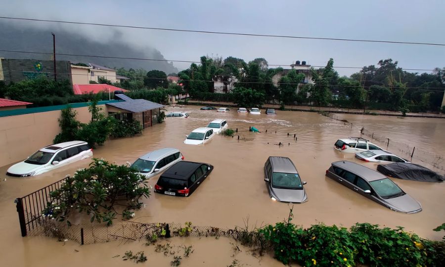
The amount of warning available to Indian authorities varies considerably depending on the type and location of the event. For conventional monsoon floods, experts estimate that India can receive anywhere from roughly 12 hours to two days of warning, depending on the river and the speed at which water travels downstream.
Water can take about a day to travel from the Nepal mountain front to the Bihar plains along the Kosi and Gandak, while the journey along the Ghaghara can take somewhat longer. Smaller rivers draining the Chure region can produce flash floods within hours.
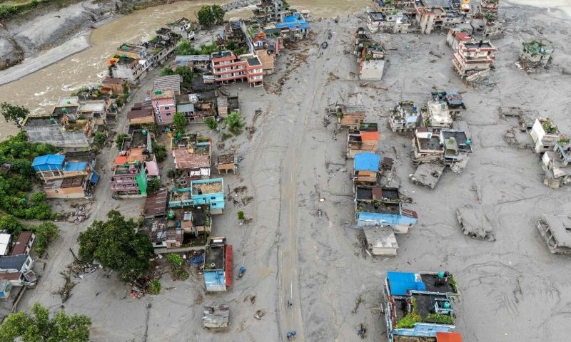
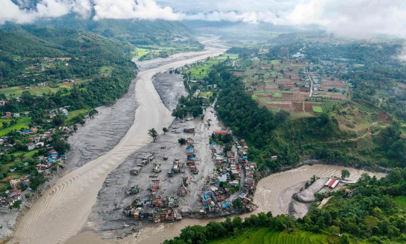
Events involving landslide-dammed lakes, sudden dam failures or debris flows can be even faster. During the latest floods, a peak surge from Rasuwa reportedly reached Triveni near the Indian border in approximately seven and a half hours.
India and Nepal already exchange real-time rainfall and river-level information through a network of monitoring stations. Nepal’s Department of Hydrology and Meteorology provides data to India’s Central Water Commission, which uses the information for flood forecasting. However, experts say significant gaps remain.
These include insufficient real-time monitoring in some rapidly responding Chure catchments, the absence of a single shared forecasting model and limited routine exchange of information on embankment conditions, sediment and changes in river channels.
The myth of Nepal “releasing” floods
One of the most common misconceptions surrounding floods in northern India is that Nepal can simply “release” large quantities of water into India. Scientists say this is an oversimplification.
Nepal does not possess large reservoirs capable of storing and suddenly releasing the enormous volumes of water associated with major Himalayan floods. Its main storage dam at Kulekhani has a relatively small capacity.
The Kosi and Gandak barrages are operated by India, meaning that major flood flows reaching the Indian side are overwhelmingly the result of rainfall upstream rather than Nepal opening floodgates.
There is, however, an important element of truth behind concerns about Nepal’s role.
A substantial proportion of the water that eventually floods north Bihar and eastern Uttar Pradesh originates as rainfall in Nepal. Consequently, rainfall patterns there can have a major influence on the timing and magnitude of flood peaks reaching India.
Nepal contributes around 40% of the Ganges’ average annual flow and an even greater proportion during the dry season, making the country’s hydrology strategically important to India. But experts caution against turning the issue into a question of blame. “Rain is not a decision,” Sanyal said, stressing that the impact of a particular flood also depends on conditions on the Indian side of the border.
India’s own infrastructure can amplify the risk
The relationship between the two countries is not simply a one-way flow of risk from Nepal into India. Indian embankments and barrages, built partly to protect communities and agricultural land from floods, can also influence water levels and drainage patterns in Nepal’s Terai region.
Nepal has long raised concerns that such infrastructure can contribute to backwater flooding on its side of the border. This makes coordinated river management particularly important.

Because the rivers cross an international boundary, effective flood management requires the two countries to share information rapidly and consistently and to coordinate forecasting, infrastructure planning and emergency responses.
The bigger warning comes from the Himalayas
Experts say the most serious lesson from Nepal’s latest disaster may not concern any single river. Instead, it points to a broader transformation in the Himalayan hazard environment, where intense rainfall can combine with melting ice, unstable slopes, landslides and huge quantities of sediment to produce highly destructive flows.
Rajiv Sinha said the latest Nepal disaster appeared similar to a series of catastrophic events that have struck India in recent years, including the 2021 Chamoli disaster and the 2025 Dharali disaster in Uttarakhand. According to Sinha, the Nepal event was potentially several times larger than those Indian disasters.
READ ALSO: Nepal Floods Kill 734, Leave 2,498 Missing
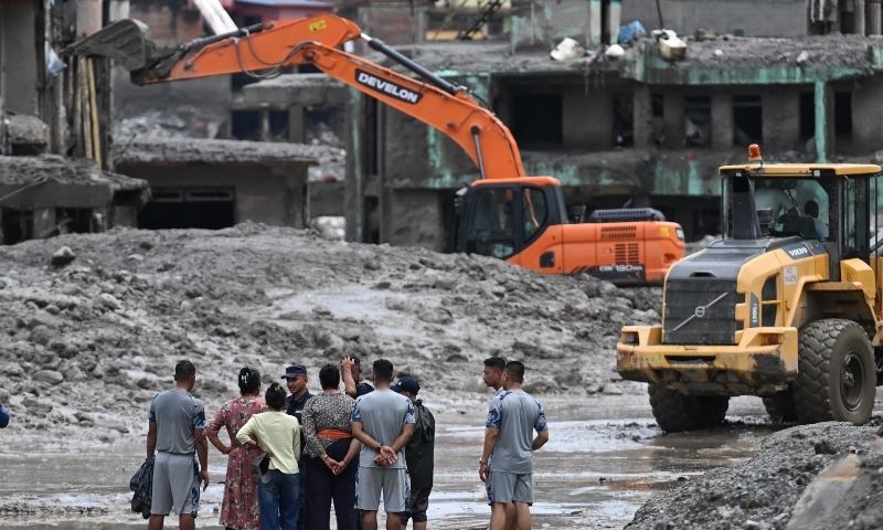
Such events differ from conventional floods, which are primarily driven by large volumes of water. When water mixes with rock, soil, ice and sediment, it can turn into a powerful debris-laden flow capable of destroying infrastructure and settlements with little warning.
The 2021 Chamoli disaster demonstrated the danger when a large mass of Himalayan material entered a river valley, producing a destructive surge that killed around 200 people and severely damaged hydropower infrastructure.
The 2025 Dharali disaster similarly highlighted the destructive potential of intense rainfall and debris flows in Uttarakhand.
Climate change adds another layer of risk
Scientists are increasingly concerned that climate change could intensify these hazards. The Himalayan region is warming rapidly, while a warmer atmosphere can hold more moisture, potentially contributing to heavier rainfall over shorter periods. At the same time, changes in glaciers, snow cover and permafrost can destabilise high-mountain terrain.
The degradation of permafrost, expansion of glacial lakes and increasing risks of glacial lake outburst floods and rock-ice avalanches could create faster and harder-to-predict flood events.
More intense rainfall can also trigger additional landslides and increase the amount of sediment entering rivers. Heavy sediment loads can raise riverbeds and reduce the effective capacity of channels, potentially increasing flood risks on both sides of the border.
Shared rivers require shared solutions
For India, therefore, Nepal’s latest floods should be seen not simply as a downstream threat but as a warning about the changing Himalayan environment. The two countries share rivers, ecosystems and hazards that do not respect political boundaries.
Experts say better real-time monitoring, joint forecasting systems, rapid data exchange and continuous assessment of glacial lakes, river channels and embankments could significantly improve preparedness.
The central challenge is to move away from a cycle of reacting to disasters after they occur and towards a coordinated system capable of identifying dangerous conditions before they develop into catastrophes.