









Key Points
- Urban flooding may hit Peshawar, Islamabad, Rawalpindi and Punjab cities.
- Flash floods threaten streams and nullahs in northern areas.
- Landslides remain possible across mountainous regions.
- Strong winds and hail may damage vulnerable structures.
- KP, Punjab, Kashmir and GB may receive widespread showers.
- Balochistan’s northeastern districts may see afternoon thunderstorms.
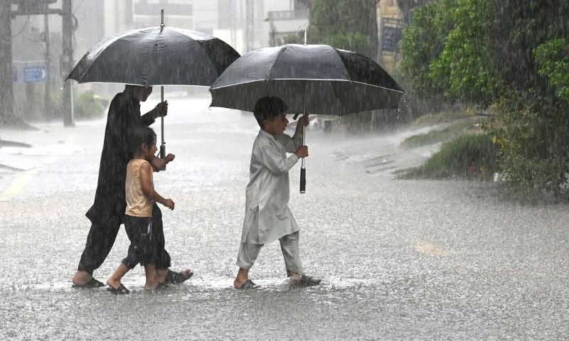
ISLAMABAD: Pakistan is bracing for another spell of rain, thunderstorms and strong winds as the Pakistan Meteorological Department (PMD) warned of urban flooding, flash floods and landslides in vulnerable areas through September 17.
The latest weather advisory, issued on Tuesday, said more rain-wind and thundershowers were likely across Khyber Pakhtunkhwa, Gilgit-Baltistan, Kashmir, Punjab and Islamabad, while northeastern Balochistan could also receive showers on Wednesday.
The weather system could bring isolated heavy rainfall and hailstorms, particularly in Kashmir, upper Khyber Pakhtunkhwa, southeastern Sindh and upper Punjab on Tuesday night, while heavy rain and hail were forecast at isolated locations in several areas on Wednesday.
Flood risk areas
The PMD warned that heavy rainfall from Tuesday night through September 17 could cause urban flooding in low-lying areas of Islamabad and Rawalpindi, Peshawar, Mardan, Swabi, Gujranwala, Gujrat, Sialkot, Faisalabad and Lahore.
The department also cautioned that heavy rain could trigger flash floods in local streams and nullahs in Dir, Chitral, Swat, Kohistan, Shangla, Battagram, Buner, Malakand, Mansehra and Abbottabad.
The risk extends to Gilgit-Baltistan, Kashmir, Murree, Galiyat, Islamabad, Rawalpindi and hill torrents of Dera Ghazi Khan, according to the advisory.
Residents in low-lying urban areas and communities near streams and nullahs have been advised to remain alert as rainfall intensity can quickly raise water levels.
Landslide threat
The PMD said landslides could occur in hilly areas of Khyber Pakhtunkhwa, Gilgit-Baltistan, Murree, Galiyat and Kashmir during the forecast period.
It also warned that windstorms, hailstorms and lightning could damage weak structures, including solar panels, electricity poles and billboards.
The warning is particularly significant for mountainous districts, where saturated slopes and intense rainfall can increase the risk of road blockages and travel disruption.
KP under watch
In Khyber Pakhtunkhwa (KP), rain-wind and thundershowers are expected in a large number of districts, including Chitral, Dir, Swat, Kohistan, Shangla, Abbottabad, Buner, Malakand, Peshawar, Charsadda, Mardan, Swabi, Nowshera and Kohat.
Other areas likely to receive showers include Hangu, Parachinar, Kurram, Bajaur, Mohmand, Khyber, Karak, Lakki Marwat, Bannu, Dera Ismail Khan and Waziristan.
Isolated heavy rainfall and hailstorms are also possible in the province.
The forecast comes after widespread rain and thunderstorms were already recorded across upper Khyber Pakhtunkhwa and adjoining parts of northern Pakistan during the previous 24 hours.
Punjab rain forecast
Punjab is also expected to experience another round of rain and thunderstorms, with showers forecast in Murree, Jhelum, Rawalpindi, Attock, Chakwal, Gujranwala, Gujrat, Narowal and Lahore.

The forecast also covers Sheikhupura, Kasur, Okara, Khushab, Sargodha, Mianwali, Faisalabad, Chiniot, Jhang, Sahiwal, Toba Tek Singh, Bhakkar, Layyah, Taunsa, Rajanpur, Multan, Khanewal, Vehari, Dera Ghazi Khan, Bahawalnagar and Bahawalpur.
Several of these districts have already received substantial rainfall, increasing the importance of drainage and flood preparedness in vulnerable locations.
Rainfall already recorded
During the 24 hours, widespread rain-wind and thundershowers occurred in Islamabad, the Potohar region, upper Punjab and upper Khyber Pakhtunkhwa, while isolated showers were reported in Kashmir, Gilgit-Baltistan and lower Sindh.
Islamabad recorded the highest rainfall totals among the listed stations, with Bokra receiving 52mm, Golra 44mm, the airport 28mm, Zero Point 25mm and Saidpur 23mm.
Okara received 50mm, while Rawalpindi recorded 44mm at New Kattarian, 42mm at Pirwadahi and 41mm at Shamsabad.
Mandi Bahauddin received 42mm, Faisalabad 26mm, Gujrat 25mm and Joharabad 23mm.
In Khyber Pakhtunkhwa, Upper Dir recorded 39mm and Malam Jabba 23mm, while Chitral received 9mm and Pattan 5mm.
Muzaffarabad received 14mm at its airport and 5mm in the city, while Babusar recorded 4mm in Gilgit-Baltistan.
Other regions
In Sindh, most districts are expected to remain hot and dry, although coastal areas may stay partly cloudy, with chances of rain in Karachi, Thatta and surrounding areas.
Balochistan is likely to remain hot and humid in most districts. However, afternoon rain-wind and thunderstorms are expected in Zhob, Musakhel, Barkhan, Sherani, Dera Bugti, Kohlu and Khuzdar.
Kashmir and Gilgit-Baltistan are also expected to remain partly cloudy with isolated rain and thunderstorms, while heavy rain and hail are possible in Kashmir.
Temperatures
The highest maximum temperature recorded on Tuesday was 44°C in Dadu, Nokkundi and Lasbella, while Dalbandin and Turbat recorded 43°C.
Among major cities, temperatures ranged from 21°C to 27°C in Islamabad, 25°C to 33°C in Lahore, 26°C to 34°C in Peshawar and 28°C to 37°C in Karachi.
Multan recorded a maximum of 38°C, while Quetta reached 37°C.
The contrasting conditions — heavy rain in northern and northeastern areas and temperatures reaching 44°C in parts of Balochistan and Sindh — reflect the uneven distribution of the current weather system across the country.