
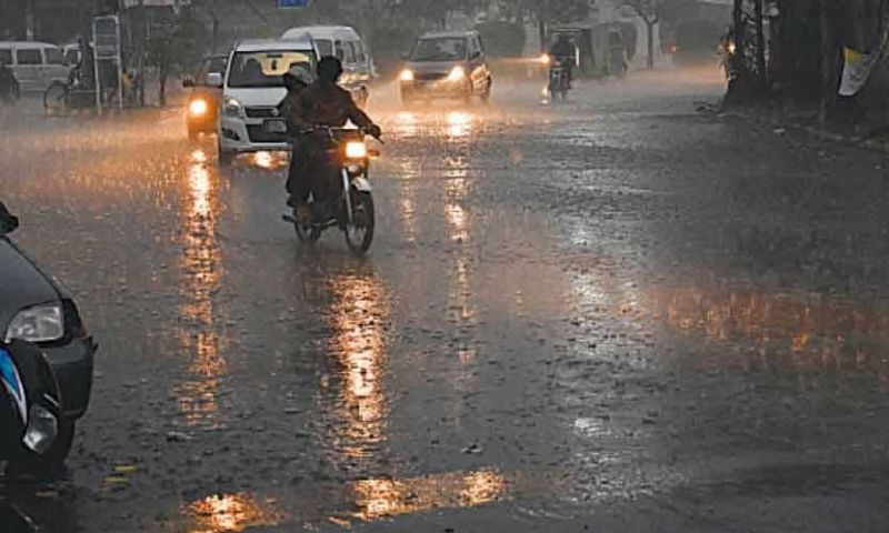


ISLAMABAD: A westerly weather system is forecasted to affect most parts of Pakistan from January 16, bringing widespread rain, thunderstorms and snowfall to large parts of the country over the coming days, the Pakistan Meteorological Department (PMD) said on Thursday.
The Met Office said a shallow westerly wave is likely to approach the upper parts of the country from the evening of January 16 and persist until January 19.
The system is expected to strengthen from January 20 and affect most regions from January 21 onwards.
Rain and snow in northern regions
From January 16 night to January 19, rain accompanied by wind and thunderstorms, along with light to moderate snowfall, is expected in Gilgit-Baltistan and Azad Jammu and Kashmir.
Affected areas include Diamir, Astore, Ghizer, Skardu, Hunza, Gilgit, Ghanche and Shigar in Gilgit-Baltistan, and Neelum Valley, Muzaffarabad, Poonch, Hattian, Bagh and Haveli in Kashmir.
Parts of upper Khyber Pakhtunkhwa, including Chitral, Dir, Swat, Kalam, Shangla, Kohistan, Battagram, Mansehra, Abbottabad, Haripur and Buner, are also forecast to receive rain and snowfall during this period.
Rain/snowfall predicated in Northern areas during coming days
Widespread rain/snowfall predicted in the country from mid of upcoming week#WeatherUpdate #PakistanWeather #Rain #Snowfall #RainAlert #SnowAlert #PMD #MetOffice #WeatherWarning #NorthernAreas pic.twitter.com/g3urSWfJ1j— Pak Met Department محکمہ موسمیات (@pmdgov) January 15, 2026
Light rain and snowfall are likely in Murree and the Galliyat from January 18 to 20.
System to intensify nationwide
The weather department said the system will intensify between January 20 and 23, bringing widespread rain and thunderstorms to Gilgit-Baltistan, Azad Jammu and Kashmir, Murree, the Galliyat, Islamabad and the Potohar region.
Several districts across Punjab are also expected to receive rain, including Sargodha, Gujranwala, Lahore, Sahiwal, Multan, Faisalabad, Dera Ghazi Khan and Bahawalpur divisions.
Rain is also forecast for parts of Khyber Pakhtunkhwa, including Peshawar, Hazara, Malakand, Mardan, Kohat, Bannu and Dera Ismail Khan divisions.
During this phase, heavy snowfall is likely in mountainous areas such as Chitral, Dir, Swat, Kalam, Shangla, Kohistan, Battagram, Mansehra, Abbottabad, Murree, the Galliyat, Neelum Valley, Bagh, Haveli and Rawalakot.
Rain in Balochistan and Sindh
Balochistan is expected to come under the influence of the system on January 21 and 22.
Rain, strong winds and thunderstorms are forecast for Quetta, Ziarat, Chaman, Pishin, Qilla Abdullah, Qilla Saifullah, Noshki, Harnai, Zhob, Kalat, Barkhan, Sibi, Loralai, Musakhel, Turbat, Gwadar, Jiwani, Lasbela, Kech, Awaran, Chaghi, Panjgur, Khuzdar, Washuk and Kharan.
Moderate to heavy snowfall is likely in Quetta, Ziarat, Chaman, Pishin, Qilla Abdullah, Qilla Saifullah, Noshki, Harnai and Zhob.
The system is forecast to reach Sindh on January 22 and 23.
Rain with strong winds and thunder is expected in Karachi and other parts of the province, including Hyderabad, Dadu, Jacobabad, Naushero Feroze, Kashmore, Larkana, Shaheed Benazirabad, Mirpurkhas and Ghotki.
Warnings and travel advisory
The Met Office warned that heavy snowfall could cause slippery conditions and road closures in several northern and western districts from the night of January 21 to January 23.
These include Naran, Kaghan, Dir, Swat, Kalam, Chitral, Kohistan, Mansehra, Abbottabad, Shangla, Astore, Hunza, Skardu, Murree, the Galliyat, Neelum Valley, Bagh, Poonch, Haveli, Quetta, Ziarat, Chaman, Pishin, Qilla Abdullah, Qilla Saifullah, Noshki, Harnai and Zhob.
There is also a risk of landslides and avalanches in hilly areas of upper Khyber Pakhtunkhwa, Gilgit-Baltistan and Kashmir.
Tourists have been advised to remain extremely cautious and avoid unnecessary travel.
The weather department said fog conditions over Punjab, Khyber Pakhtunkhwa and upper Sindh are likely to ease during the wet spell, while daytime temperatures are expected to drop significantly across many regions.
NDMA issues cold wave alert
Meanwhile, the National Disaster Management Authority (NDMA) issued a cold wave alert for upper and northern regions, including Gilgit-Baltistan, upper Khyber Pakhtunkhwa and Azad Jammu and Kashmir.
In a statement issued by its National Emergencies Operations Centre, the NDMA warned of very cold to extremely cold conditions, particularly at night and in the early morning, with daytime temperatures remaining below normal.
The authority forecast moderate to heavy snowfall in high-altitude and hilly areas, which could disrupt road connectivity, transport and power supply.
Adjoining plains are expected to experience cold and dry weather, with frost formation in isolated areas.
The NDMA cautioned that the conditions could increase the risk of avalanches and landslides and pose health risks, especially for children, the elderly and people with pre-existing medical conditions. Frost may also damage standing crops and orchards.
The authority advised the public to avoid non-essential travel to snowfall-prone areas, use snow chains where travel is unavoidable, and make arrangements for heating, warm clothing and shelter.
Provincial and district authorities were directed to remain on high alert.
Earlier this week, the PMD dismissed reports of an “extreme cold wave” expected from January 16 to 25, saying temperatures during the period would remain within the normal winter range, based on its latest numerical weather analysis.