

Key points
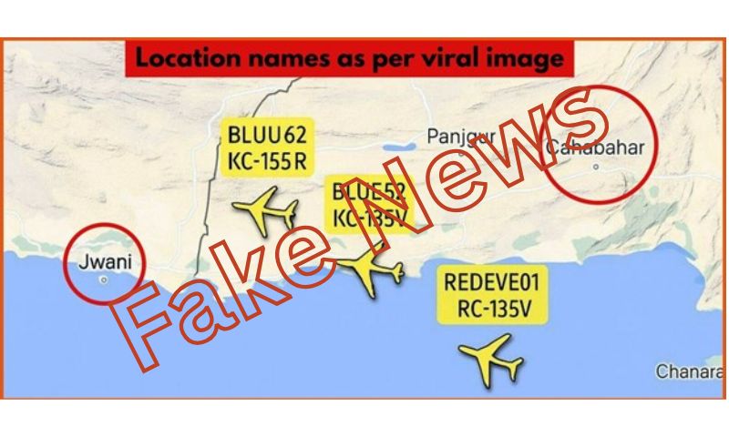
- Map showed several geographical and factual inaccuracies
- Iran is incorrectly shown to the right of Pakistan
- The spellings of “Jwani” and “Cahabahar” are also incorrect
- The map wrongly places Chabahar within Pakistan and Jiwani in Iran
ISLAMABAD: Concerted malicious efforts are being made by Indian media and social media accounts that are spreading fake news about Pakistan being asked for military bases in the ongoing Israel-Iran war, and also false claims that Pakistan air airspace is being used for intelligence collection.
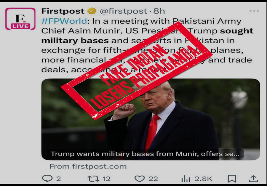
These are baseless, absurd, and ridiculous propaganda claims being churned out by Indian media and its proxies to defame Pakistan, according to the Ministry of Information and Broadcasting.
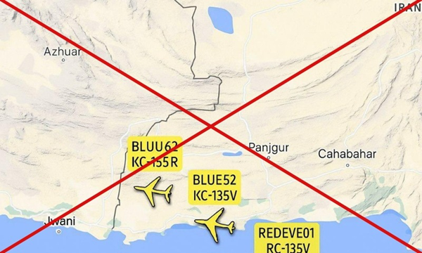
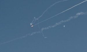
Viral flight map showing Pakistan allowing US flights near sensitive spots on the Iran border.
On 17 June 2025, several Indian users on the social media platform X circulated an air traffic map, alleging that Pakistan was assisting the United States in gathering critical intelligence on Iran’s sensitive locations amid the ongoing conflict with Israel.
However, the image was found to be fabricated, containing numerous inconsistencies.
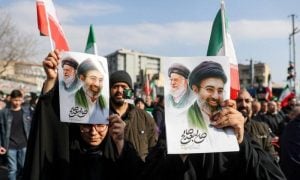
Spreading sectarian discord
One Indian account posted an airspace monitoring map that appeared to show four aircraft flying over Pakistani territory. The accompanying caption stated: “Multiple US Air Force refuelling planes and an RC-135V Rivet Joint surveillance aircraft flew parallel to Iran’s sensitive areas within Pakistani airspace today, unchallenged by the Pakistan Air Force—indicating that the largely Sunni Pakistan Army is backing Israeli strikes on Shia Iran.”
The post garnered 56,100 views.
Given the post’s virality, the public’s strong interest in the unfolding situation, and the spread of speculation regarding Pakistan’s alleged role in the Israel-Iran conflict, a fact-check was conducted by iVerify Pakistan to assess the authenticity of the claim.
No credible reports
A keyword search using terms such as “Pakistan”, “Iran”, “US”, and “air force” revealed no credible reports in either Pakistani or international media confirming the alleged incident, nor were there any verifiable sources supporting the claim.
Examining the map showed several geographical and factual inaccuracies, which are pointed out below:
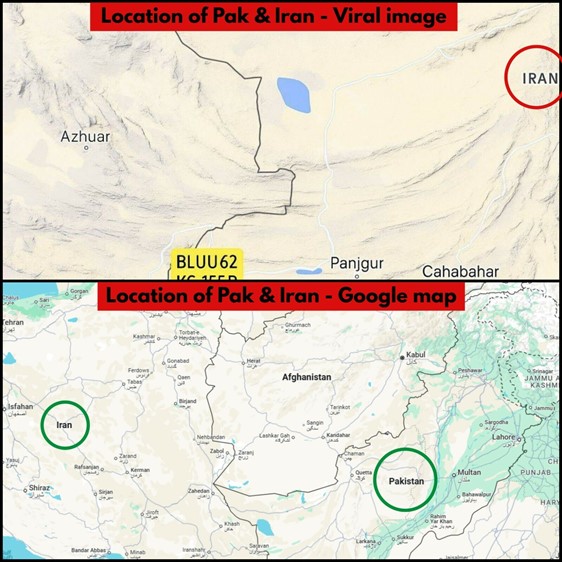
Iran is incorrectly shown to the right of Pakistan, whereas it is located to the west (left side) of Pakistan on Google Maps.
Gwadar is inaccurately depicted on the far bottom left of the map across a river, whereas in reality, it is located on the coastline.
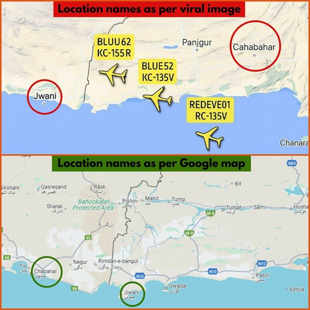
Incorrect spellings
The spellings of “Jwani” and “Cahabahar” are also incorrect; the correct spellings, as verified by Google Maps, are “Jiwani” and “Chabahar” respectively.
All the places shown on the map lie within Balochistan, a province of Pakistan, yet the map wrongly places Chabahar within Pakistan and Jiwani in Iran. It even creates ambiguity over whether Gwadar is situated in Oman.
Furthermore, the map incorrectly shows Panjgur to the west of Chabahar, which is contrary to its actual location according to Google Maps.
The aircraft labelled “KC-155R” does not exist — the correct model is the KC-135R, an American military aerial refuelling tanker aircraft.
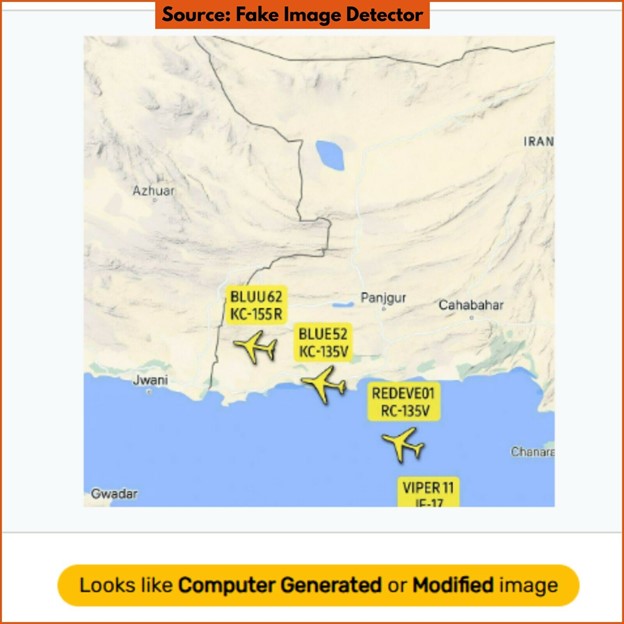
Tools to detect AI manipulation were inconclusive about the image, but Fake Image Detector indicated that it was a “computer-generated or modified image”.
The claim about a viral flight map showing Pakistan helping the US by allowing flights close to sensitive locations near the Iran border is false.
The flight map is fake with numerous discrepancies and no report exists corroborating any such development.