


MIAMI: Forecasters have issued warnings regarding Tropical Storm Philippe, which poses a significant threat to the Leeward Islands, bringing heavy rains and the potential for flash flooding on Monday.
The storm is expected to later curve out into the central Atlantic, where it could potentially gain hurricane status by midweek.
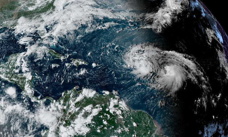
As of 2 a.m. on Monday, the U.S. National Hurricane Center in Miami reported that Philippe was located approximately 130 miles (215 kilometers) east-northeast of Guadeloupe, or about 160 miles (255 kilometers) east-southeast of Barbuda. The storm’s sustained winds were measured at 50 mph (85 kph), and Philippe was moving at a slow pace to the northwest at 6 mph (9 kph).
Antigua and Barbuda were placed under a tropical storm watch due to the storm’s trajectory. The hurricane center advised that those in the northern Leeward Islands closely monitor Philippe’s progress, as the storm’s center is projected to pass near or just northeast of the area on Monday and Monday night.
In addition to the threat of strong winds, heavy rainfall from Philippe could lead to isolated to scattered flash flooding across Barbuda and Antigua through Tuesday, according to the advisory.
Meteorologists mentioned that although strong wind shear is anticipated to hinder Philippe’s strengthening in the coming days, changing weather conditions could create an opportunity for it to escalate to hurricane status later in the week, particularly as it moves into the central subtropical Atlantic. The situation calls for heightened vigilance and preparedness from the affected regions.