

LONDON: Distinctive 3-D images of the most famous ship have been revealed for the first time since it sank in the Atlantic in 1912.
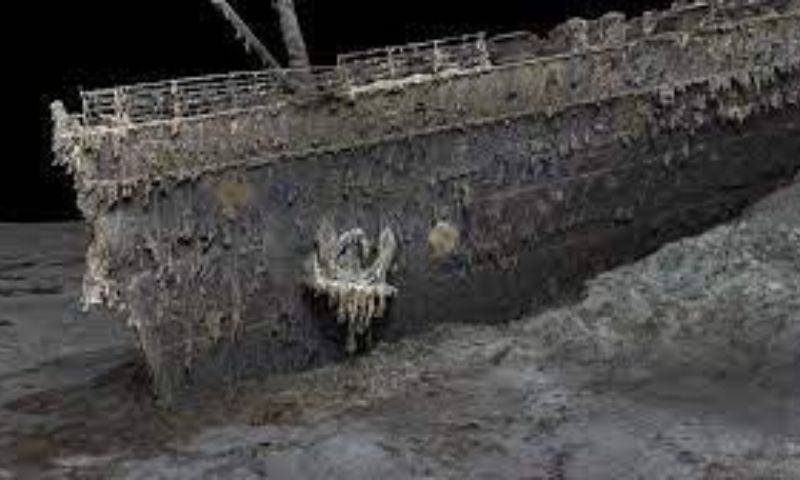
Deep-sea mapping has showcased the first full-sized digital scan of the Titanic, located 3,800m (12,500ft) beneath the Atlantic. The entire ship may be viewed in the distinctive 3D vision after the water from the wreck has been drained away.

Hopefully, this will illuminate precisely what happened to the liner, which sank in 1912. When the ship hit an iceberg while on its first journey from Southampton to New York, about 1,500 people died. Titanic analyst Parks Stephenson told the BBC that a few key issues concerning the ship still need to be addressed.
He noted that the model was one of the first significant steps to turning the Titanic story towards evidence-based research and not speculation.” Since the wreck of the Titanic was discovered in 1985, it has been thoroughly investigated. But cameras can never capture the entire ship in compelling detail in the deep darkness because it’s so big.
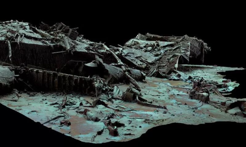
With the help of the new scan, the Titanic can be seen completely. The bow and stern are separated by around 800 meters (2,600 feet) on either side. A vast field of wreckage surrounds the wrecked vessel. The deep-sea mapping company Magellan Ltd. and Atlantic Productions, producing a documentary on the project, conducted the scan in the summer of 2022.
Over 200 hours were spent examining the wreck’s length and breadth using submersibles remotely controlled by a crew on board a specialized ship. For the precise 3D reconstruction, they took almost 700,000 pictures from every aspect.
It was the greatest underwater scanning effort that Magellan’s Gerhard Seiffert, who supervised the planning for the expedition, had ever done.
“The depth of it, almost 4,000m, represents a challenge, and you have currents at the site, too — and we’re not allowed to touch anything to not damage the wreck,” he said.