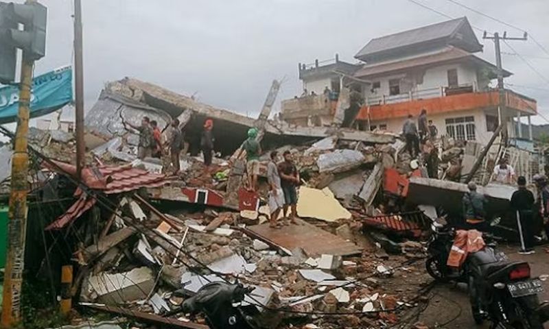


JAKARTA, Indonesia: On Wednesday, the eastern side of Indonesia experienced a powerful undersea earthquake without any immediate reports of casualties or damages.
The quake, measuring 6.0 in magnitude, struck 94 kilometers (58 miles) west of Tobelo in the North Maluku province, reaching a depth of 116 kilometers (72 miles). While Indonesia’s Meteorology, Climatology, and Geophysical Agency assured no tsunami threat, they cautioned about potential aftershocks.
Indonesia, housing over 270 million people across its vast archipelago, experiences frequent seismic activity, including earthquakes and volcanic eruptions due to its location on the “Ring of Fire,” a zone of seismic faults encircling the Pacific Basin.
Last year, a magnitude 5.6 earthquake struck Cianjur city in West Java, claiming the lives of at least 331 individuals and injuring nearly 600. This incident marked the deadliest earthquake in Indonesia since 2018, when a quake and tsunami in Sulawesi caused approximately 4,340 fatalities.
In 2004, a tremendously powerful earthquake in the Indian Ocean triggered a devastating tsunami, resulting in the loss of over 230,000 lives across a dozen countries. The majority of these casualties occurred in Indonesia’s Aceh province.