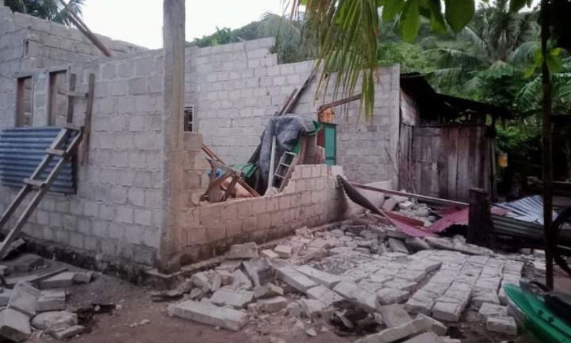


JAKARTA: An earthquake of magnitude 7.3 struck Indonesia’s Sumatra Island on Tuesday, prompting a tsunami warning for nearby coastlines and forcing thousands of residents to flee coastal areas.
Footage released by the National Disaster Mitigation Agency showed crowds of people in a village on Mentawai Island fleeing to higher ground by foot and motorcycles under the rain, while some patients at the village’s hospital were evacuated to its yard after cracks appeared in the facility’s floor.
The shocks were felt in areas of West Sumatra and North Sumatra provinces.
Residents in parts of West Sumatra province, including its capital Padang, felt the tremor strongly for about 30 seconds, agency spokesperson Abdul Muhari said.
The magnitude 7.1 quake was centered 170 kilometers (105 miles) southeast of Teluk Dalam, a town and district in the South Nias Regency, at a depth of 15 kilometers (9 miles), the US Geological Survey said. Aftershocks measured as strong as 5.8.
Indonesia’s Meteorology, Climatology and Geophysical Agency issued an initial tsunami alert but lifted it just before dawn, around two hours after the earthquake. The agency initially put a preliminary magnitude at 7.3, before revising it to 6.9.
Variations in early measurements are common.
The head of the agency’s Earthquake and Tsunami Center, Daryono, who goes by a single name, said that as per sea-level observations, minor tsunamis of 11 centimeters were detected in Tanah Bala coastal area of South Nias regency.
Indonesia, a country of 270 million people in Southeast Asia and Oceania, is frequently struck by tremors, volcanic eruptions and tsunamis.
In November, a magnitude 5.6 earthquake killed at least 340 people and damaged more than 62,600 homes in part of West Java.