


Key points
- Hyperspectral Satellite named HS-1 launched from China’s Jiuquan Space Centre
- SUPARCO says it will aid crop monitoring, water management, and disaster response
- Collaboration with China marks key step in Pakistan’s National Space Vision 2047
- Experts say HS-1 imaging can detect soil health, vegetation stress, pollution levels
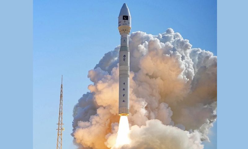
ISLAMABAD: Pakistan on Sunday successfully launched its first hyperspectral Earth-observation satellite, HS-1, from China’s Jiuquan Satellite Launch Centre, marking what officials described as a “historic leap” in the country’s space technology programme.
In a statement quoted by the state media, the Space and Upper Atmosphere Research Commission (SUPARCO) said the launch of HS-1 would “usher in a new era of advanced observation and data analysis for agriculture, environment, water resources, and disaster management.”
SUPARCO explained that a hyperspectral satellite captures light in hundreds of narrow colour bands, instead of the usual three—red, green, and blue—used by ordinary cameras. This allows scientists to detect subtle differences in soil composition, crop health, vegetation stress, water quality, and even pollution levels.
According to the agency, data from HS-1 will help Pakistani authorities and researchers to improve crop-yield estimation by up to 15–20 per cent, monitor forest cover, study glacial melt in the northern regions, and strengthen early-warning systems for floods and landslides. SUPARCO stated that the satellite’s sensors would also aid in urban planning and infrastructure mapping by providing detailed imagery of land use and environmental changes.
The launch was carried out in cooperation with Chinese partners, continuing a long-standing collaboration between the two countries in the field of space science. Pakistan’s earlier advanced remote-sensing satellite was launched on July 31, 2025, following the PRSS-1 launch on July 9, 2018.
“The successful deployment of HS-1 reflects the deep and enduring cooperation between Pakistan and China in peaceful uses of space,” SUPARCO said, noting that the mission supports the country’s National Space Programme 2047, which aims to expand indigenous capabilities in Earth observation, satellite communications, and climate-related research.
Analysts told Gulf News and Arab News that hyperspectral imaging has already transformed precision agriculture and resource management in other parts of the world. The technology enables the detection of moisture stress or nutrient deficiency in crops before visible signs appear, allowing timely intervention by farmers and policymakers.
Observers said the next challenge for Pakistan would be to develop ground-processing infrastructure capable of turning the raw satellite data into actionable insights. Experts told Business Recorder that timely data delivery and inter-agency coordination would determine how effectively the new satellite benefits ordinary citizens.
While Pakistan currently relies on Chinese launch facilities, officials say local capacity is steadily expanding. SUPARCO reaffirmed its commitment to building “a robust space ecosystem that directly contributes to national development and socio-economic well-being.”
International media, including Anadolu Agency and Gulf News, described the HS-1 launch as a notable step toward technological self-reliance and climate resilience for a country frequently hit by floods and droughts.