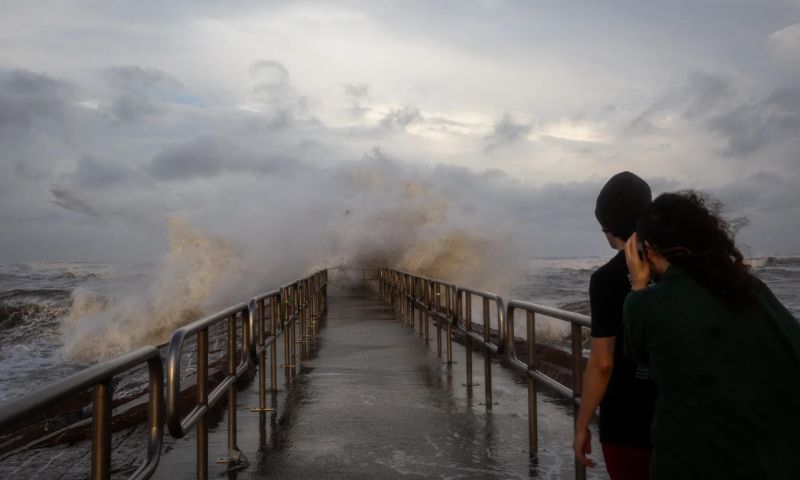


NEW YORK: The remnants of Hurricane Beryl that moved across parts of central New York pose a great tornado threat highest in nearly 20 years.
Beryl and a passing frontal boundary could cause a dual severe weather risk for the US Northeast, bringing a rare tornado threat along with possible flooding by Thursday morning.
Some scattered showers have already started to affect the region but are likely to increase in coverage and intensity throughout the day on Wednesday.
Throughout its journey across the eastern US, the hurricane has already posed the highest tornado threat. Monday saw the highest number of Tornado Warnings on a single day in July, totalling 118.
The tornado threat is highest in nearly 20 years across parts of central New York.
“That should say something that should grab your attention,” FOX Weather Meteorologist Craig Herrera said. “Watch for those supercells to develop this afternoon. You want to make sure that you’ve got a safe spot to go to.”
The worst weather is forecasted from mid-afternoon into the evening. Thunderstorms across the Northeast also carry a threat of damaging wind gusts of 60 mph or higher.
NOAA’s Weather Prediction Center has marked parts of New York, Vermont and New Hampshire with moderate risk for flooding which could increase later. Many communities in Vermont experienced between 5-10 inches of rainfall.
This meteorological phenomenon develops when warm air rises over mountains but cools and condenses as it goes high in the air. This leads to the formation of heavy clouds and rainfall, which can be quite heavy and unpredictable.