


ISLAMABAD: The very severe cyclonic storm (VCSC) BIPARJOY, which had wreaked havoc on Indian coastal regions and was now hovering over the Rann of Kutch, became weaker after losing strength.
In the last three hours, the VSCS “BIPARJOY” over the Rann of Kutch (India) moved further northeast, weakening into a Cyclonic Storm (CS), and now lying near Latitude 23.8°N and Longitude 69.4°E at a distance of 110km south of Badin, 200km southeast of Keti Bandar, and 180km southeast of Thatta.
Although the water conditions were over the Northeast Arabian water, the maximum sustained surface winds had also decreased to 80–100 km/hour, leading wave height to rise to 10–12 feet.
By this evening (Friday), according to the PMD and Met Office, the system (weather pattern) was projected to weaken considerably further and turn into a depression.
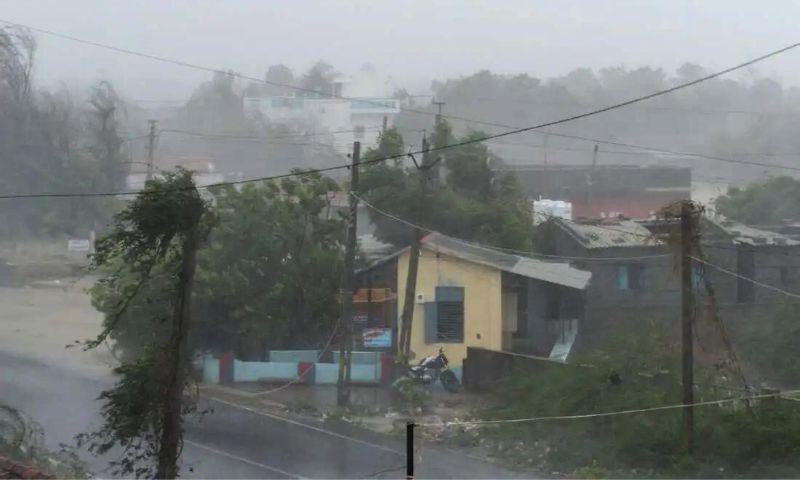
According to the situation report, Friday and Saturday will likely bring widespread rain and thunderstorms with heavy to very heavy rainfall and squally winds of 80 to 100 km/h in the districts of Sujawal, Badin, Tharparker, and Umerkot, as well as Thatta and Mirpurkhas.
It further stated that today (Friday) was anticipated to be dusty with thunderstorm-like rain with a few light falls and gusty gusts of 30 to 50 km/h in Karachi, Hyderabad, Tando Muhammad Khan, Tando Allayar, Shaheed Benazirabad, and Sanghar districts.
The loose and exposed buildings (Kutcha or Mud homes) in the districts of Thatta, Sujawal, Badin, Tharparker, and Umerkot may sustain damage from the squalls.
The status assessment also made clear that a storm surge of 2 to 2.5 metres (6 to 8 feet) was anticipated in Keti Bandar, and that the sea conditions in the area along the Sindh-Makran coast were likely to be difficult and very stormy (with a 2-meter tide).
Additionally, it cautioned the fishermen from venturing out into the open ocean until the system had passed by June 17.
All relevant authorities were specifically instructed by the Met Office to stay ‘ALERT’ during the predicted period.