


BEIJING: China has successfully launched synthetic aperture radar satellite into a high-altitude orbit, as the China National Space Administration confirmed.
The newly launched remote sensing satellite, Land Surveyor 4A, is the world’s first synthetic aperture radar dedicated to preventing and mitigating natural disasters.
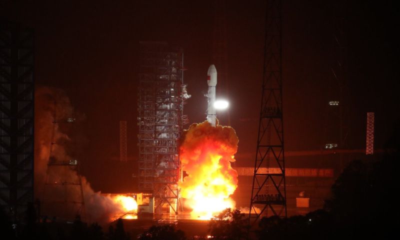
Riding aboard a Long March 3B rocket, the satellite soared into space from the Xichang Satellite Launch Center located in Sichuan province. It rapidly entered its intended geosynchronous orbit, marking a significant milestone in China’s space endeavors.
Remote sensing involves the meticulous detection and monitoring of an area’s physical attributes by measuring the radiation it reflects and emits, usually from satellites or aircraft, as reported by ecns.cn.
The Land Surveyor 4A satellite, developed by the China Academy of Space Technology, is set to enhance China’s disaster monitoring capabilities from space significantly. Its primary role entails continuous surveillance over Chinese territories and adjacent regions.
Synthetic Aperture Radar’s Functions
Beyond disaster management, the satellite’s applications extend to land and marine resource management, weather prediction, and environmental preservation, as well as agricultural and forestry fields.
Distinguished by its superior monitoring and imaging capacities compared to other synthetic aperture radar satellites in low orbits and optical satellites, this particular type of satellite is adept at capturing observations and images despite harsh sunlight and thick cloud cover.
This launch represents China’s 35th rocket mission in 2023 and the 483rd flight undertaken by the Long March rocket family, the backbone of China’s launch vehicle fleet.